Standardizing National Geographic Data with KUGI Guidelines
My intern journey at Geological Survey Agency
Crafting Detailed Geomorphology Maps of Indonesia
This project was a collaborative effort aimed at providing vector national geomorphological data for the GeoMap portal, part of the Integrated Map Services Portal of Indonesia.
Project Overview
Objective: Convert raster data into detailed vector geomorphology maps of Indonesia.
Tools Used: ArcGIS, including polygon and freehand digitizing tools.
Team: Collaborated with a dedicated team of 11 members.
Result
The project was organized by dividing the regions among team members, and I was assigned Sumatra, Mentawai, and Belitung Island. The source data for this project was provided by the Geological Survey Agency in the form of raster data.
This also includes digitizing the raster to the smallest detail possible. To create detailed vector geomorphology maps, I used ArcGIS tools to digitize the raster data. Specifically, I employed the smooth polygon and freehand tools to accurately trace and convert the features of Sumatra Island. This process was taking a total of three days to complete.
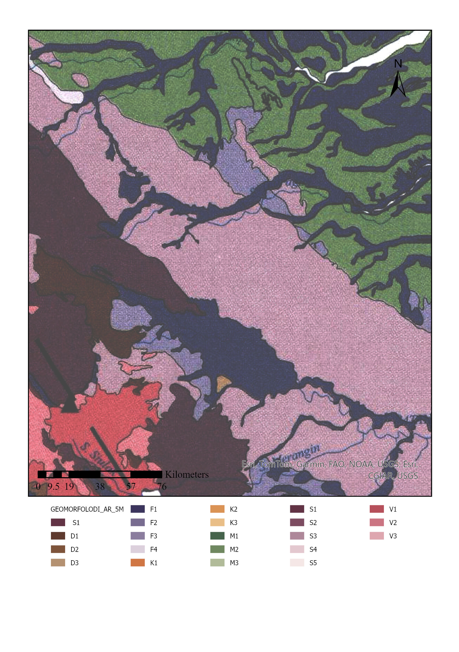
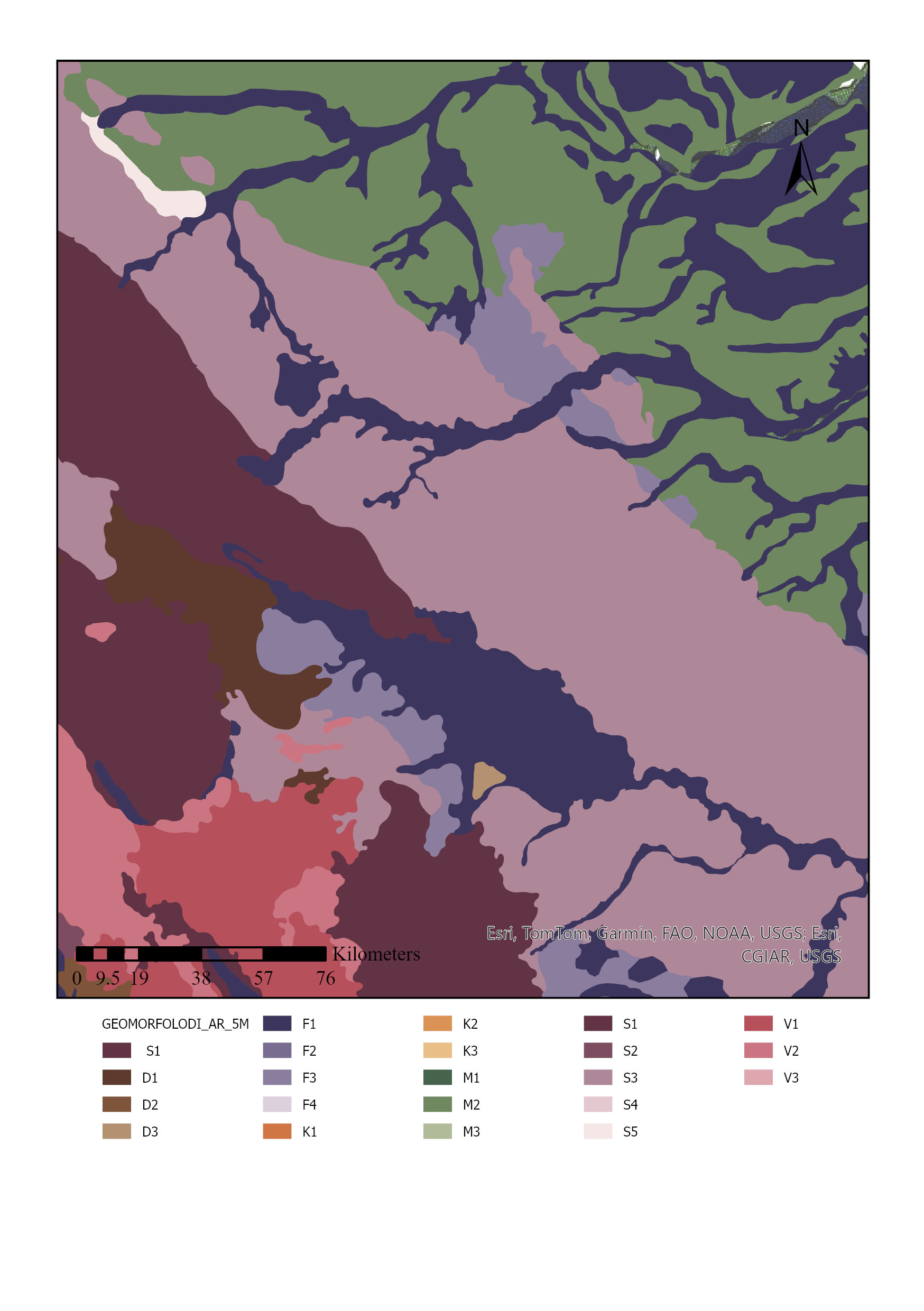
Vector data can load attribute table information for each polygon, which raster data cannot provide. This project aimed to leverage this advantage to make the morphological features of Indonesia easier to interpret. The attribute tables for the vector data were standardized according to the Katalog Unsur Geografi Indonesia (KUGI).
The results were then all combined to produce national geomorphological vector data and evaluated against the current coastline.
Vector Standarization
In contrast to the first project, which focused on raster data, this second project centers on vector data. The task involves managing and standardizing geological data at a 1:100,000 scale, divided into ten 1:50,000 scale maps covering Pacitan and Kudus. The goal is to ensure that the geological data is organized and consistent with national standards, specifically the Katalog Unsur Geografi Indonesia (KUGI) guidelines.
Overview
Objective: Align the geological data of Pacitan and Kudus maps with the Katalog Unsur Geografi Indonesia (KUGI) standards.
Scope: Manage and standardize data from six geological maps of Kudus and four from Pacitan.
Method
- Load Data The first step involves creating a clean and blank geodatabase for each geological map. Next, the fields are filled according to Katalog Unsur Geografi Indonesia (KUGI) standards. Existing geological data at a 1:50,000 scale is then loaded using the Data Loader tool in ArcGIS.
The current data is not standardized, so we need to create a new geodatabase to ensure it meets the required standards.
- Reviewing Attribute Tables The next step involves data cleaning and correction, including removing inconsistencies and standardizing attributes according to KUGI guidelines to ensure uniformity. Inconsistencies could include differences in rock formation names and symbols, typos, and non-standard writing. The solution is to compare with regional geology, DEM data, or review papers to ensure accuracy. This process is applied to the other nine geological datasets as well, ensuring that the maps are accurate and comparable across different regions.